Lighthouses

Mexico

Baja California Lighthouses

The Baja California region of Mexico is a peninsula more than 1300 km (800 miles) long, stretching south from the U.S. border at Tijuana to the resorts of Cabo San Lucas. "Baja," as it is usually called, separates the Pacific on the west from the Sea of Cortés (Gulf of California) on the east. The west coast is popular with surfers and the east coast attracts sea kayakers and ecotourists.

Many of these lighthouses are in remote areas and are seldom visited. Additional information and photos would certainly be welcome.

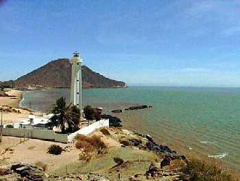
Because of the rugged topography of the peninsula, most lighthouses are short towers located at the tops of bluffs or ridges overlooking the sea.

Mexican lighthouses are managed by the Secretaría de Comunicaciones y Transportes, the cabinet agency that also manages the country's airports and seaports. Many of the larger light stations are staffed by resident civilian keepers.

ARLHS numbers are from the ARLHS World List of Lights. Admiralty numbers are from volume G of the Admiralty List of Lights & Fog Signals. All U.S. NGA numbers are from Publication 111.


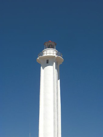
Faro de Tijuana, August 2005
anonymous Creative Commons photo

Pacific Coast Lighthouses
* Tijuana
Date unknown. Active; focal plane 32 m (105 ft); white flash every 6 s. 22 m (72 ft) cylindrical white concrete tower, unpainted. A photo appears above, and another closeup photo is available. The lighthouse was built fairly recently as part of a plan to develop Tijuana's beachfront. Located next to the beach just a few feet from the U.S. border and the "Bullring by the Sea" (Plaza de Toros Monumental), which is part of the same development. Google has a satellite view. Site open, tower closed. ARLHS MEX-083; Admiralty G3635.5; NGA 14338.
Islas las Coronados North (1)
Date unknown. Inactive. White pyramidal tower with 1-story keeper's house. A closeup photo is available. The islands are about 42 km (26 mi) southwest of San Diego. Located on a ridge at the north end of South Coronado Island. Accessible only by boat. ARLHS MEX-111.
Islas las Coronados North (2)
Date unknown. Active; focal plane 75 m (246 ft); two white flashes every 10 s. 10 m (33 ft) octagonal cylindrical white concrete tower with lantern and gallery. A rather distant photo is available. Located high on the ridge above the older lighthouse. Accessible only by boat. ARLHS MEX-110; Admiralty G3635; NGA 14344.
Islas las Coronados South
Date unknown. Active; focal plane 48 m (157 ft); three white flashes every 12 s. 6 m (20 ft) cylindrical white concrete tower with lantern and gallery. A photo is available. Located on a steep rocky bluff at the south end of South Coronado Island. Accessible only by boat. ARLHS MEX-112; Admiralty G3634; NGA 14348.
Islas de Todos Santos (1)
Date unknown. Inactive. Stone tower, about 14 m (45 ft tall), attached to a 1-story stone keeper's house. Lantern removed. The building is abandoned and deteriorating. A distant photo and a small closeup photo are available. ARLHS MEX-109.
Islas de Todos Santos (2)
Date unknown. Active; focal plane 49 m (161 ft); white flash every 7 s. 30 m (98 ft) concrete tower with two galleries; lighthouse painted with orange and white bands. A distant photo and a small closeup photo are available. The lighthouse is on the northwest tip of the northern of the two islands of Todos Santos, located in the Bahía de Ensenada about 20 km (13 mi) west of Ensenada. The islands are well known as a surfing site. Accessible only by boat. Site open. ARLHS MEX-078; Admiralty G3620; NGA 14364.
* Punta San José
Date unknown. Active; focal plane 35 m (115 ft); four white flashes every 16 s. 10 m (33 ft) cylindrical white concrete tower with gallery; no lantern. A fine closeup and a distant photo are available. A site popular with surfers, Punta San José is 24 miles west of Santo Tomas by a dirt road. The lighthouse stands on a bluff overlooking the beach. Site open. ARLHS MEX-184; Admiralty G3619.5; NGA 14380.

Faros de las Islas de Todos Santos, January 2004
Creative Commons photo by Leonardo Galicia
Isla San Jeronimo
Date unknown. Active; focal plane 47 m (154 ft); two white flashes every 10 s. 6 m (20 ft) white hexagonal masonry tower with red lantern; solar-powered lens. No photo available. This lighthouse is probably typical of many small light towers on the Mexican coast. Located at the summit of the island southwest of San Quintín. Accessible only by boat. Site open, tower closed. ARLHS MEX-108; Admiralty G3616; NGA 14396.
Islas San Benito
Date unknown. Active; focal plane 130 m (426 ft); three white flashes every 20 s. 17 m (56 ft) white tower with keeper's house; lantern painted black. Philip Colla has a photo (2/3 of the way down the page). The islands, home to numerous birds and elephant seals, are a popular destination for ecotours, which often visit the lighthouse. Located atop the largest island, located northwest of Isla Cedros and about 80 km (50 mi) west of the peninsula. Accessible only by boat. Site open. ARLHS MEX-071; Admiralty G3613; NGA 14412.
Isla Cedros
Date unknown. Active; focal plane 11 m (36 ft); four white flashes every 16 s. 6.5 m (21 ft) square pyramidal concrete tower with gallery. Entire lighthouse is white. A photo is available (at the bottom of the page). Located at the northern point of Isla Cedros, a large island, about 65 km (40 mi) west northwest of Guerrero Negro. Accessible only by boat. Site open, tower closed. Admiralty G3610; NGA 14448.
* Guerrero Negro (Puerto Venustiano Carranza, Laguna Ojo de Liebre)
Date unknown. Inactive. Approx. 16 m (52 ft) round cylindrical concrete tower with gallery and four ribs. The lantern has disappeared, although it is seen in an older photo. Entire lighthouse painted white. This lighthouse guided ships ariving to load salt at the Laguna Ojo de Liebre, also called Scammon's Lagoon. It was replaced by a series of range lights on wooden posts marking the twisting entrance. Located at the wharf of the salt works, about 12 km (7.5 mi) southwest of Guerrero Negro (now known officially as Puerto Venustiano Carranza). Google has a satellite view. Site open, tower closed.
Isla Natividad
Date unknown. Active; focal plane 111 m (364 ft); two white flashes every 10 s. 16 m (52 ft) gray masonry tower rising from a 1-story keeper's house. A very distant photo is available (the lighthouse is at the extreme right of the photo), and there is a photo taken through a window of the lighthouse (1/3 the way down the page). Isla Natividad is off Punta Eugenia, about 65 km (40 mi) west of Guerrero Negro. The island is popular with surfers. Located at the highest point of the island; Google has a satellite view. Accessible only by boat. Site open; tower apparently open. ARLHS MEX-040; Admiralty G3606; NGA 14456.
* Punta Abreojos
Date unknown. Active; focal plane 25 m (82 ft); three white flashes every 12 s. 20 m (66 ft) ribbed concrete tower with lantern and gallery. Joe Makares has contributed a photo, and Roy Baldwin has posted a photo from the other side. Accessible by 4WD: Punta Abreojos is at the end of 84 km (52 mi) of dirt road. In 2004 at least part of the road was being paved. Located on the beach at the south end of town; Google has a satellite view. Site open, tower closed. ARLHS MEX-047; Admiralty G3600; NGA 14480.
* Puerto López Mateos
Date unknown. Active; focal plane 13 m (43 ft); white flash every 6 s. 10 m (33 ft) round cylindrical concrete tower with gallery centered on a square concrete base. Lighthouse painted with red and white horizontal bands. A photo is available. Located on the waterfront of Puerto López Mateos. Site open, tower closed. Admiralty G3598.5; NGA 14496.5.
Cabo San Lazaro
Date unknown. Active; focal plane 70 m (230 ft); white flash every 6 s. 7 m (23 ft) white square tower rising from the seaward side of a 1-story keeper's house. No photo available, but Google has a satellite view. Located on the cape, which juts into the Pacific west of San Marcos. This is a remote site, difficult to access. Site status unknown. ARLHS MEX-102; Admiralty G3598; NGA 14500.
Punta Tosca
Date unknown. Active; focal plane 81 m (266 ft); white flash every 6 s. White square tower with keeper's house. No photo available, but Google has a satellite view. Located on the point of Punta Tosca, the rugged southermost tip of Isla Santa Margarita, at the southern end of Bahía Magdalena. Accessible only by boat. Site status unknown. ARLHS MEX-128; Admiralty G3592; NGA 14532.

Faro de Punta Abreojos
photo copyright Joe Makares; used by permission
 
* Todos Santos
Date unknown. Active; focal plane 13 m (43 ft); white flash every 6 s. 10 m (33 ft) round cylindrical concrete tower with gallery centered on a square concrete base. Lighthouse painted with black and white horizontal bands. An excellent photo is available. Located near Todos Santos, a town about 45 km (28 mi) north of Cabo San Lucas. Site open, tower closed. ARLHS MEX-077; Admiralty G3591; NGA 14544.
* Cabo Falso (1) ("Faro Viejo")
1890?. Inactive since 1967. Approx. 9 m (30 ft) octagonal cylindrical stone tower, rising from a 1-story stone keeper's house. A good closeup, several additional closeup photos, and another photo are available. Despite its name, the lighthouse is not truly at Cabo Falso but is at the westernmost extension of Cabo San Lucas about 5 km (3 mi) southwest of the town. Located atop a bluff at a point of the cape; Google has a satellite view. Site accessible by horseback or ATV from the resorts of the Cabo San Lucas area. Site open, tower status unknown. ARLHS MEX-101.
* Cabo Falso (2)
1967. Active; focal plane 190 m (623 ft); white flash every 6 s. 6 m (20 ft) hexagonal cylindrical concrete tower with lantern and gallery, painted with red and white horizontal bands. A distant photo is available. Located on heights above the cape; Google has a satellite view. Site open, tower closed. ARLHS MEX-102; Admiralty G3586; NGA 14548.
*** Cabo San Lucas Range Front
Date unknown. Active; focal plane 26 m (85 ft); white light, 1 s on, 2 s off. 20 m (65 ft) (?) white tower with an observation room and gallery topped by a flat roof. The navigation light appears to be mounted on the gallery rail. The rear range light is on an 8 m (26 ft) skeletal tower on a hillside about 290 m (315 yd) west northwest. The lighthouse is built on the roof of the Costa Real Cabo resort hotel on the Cabo San Lucas beachfront, overlooking the yacht harbor. A closeup photo is available, and Google has a satellite view. Site and tower open. Site manager: Costa Real Cabo. ARLHS MEX-103; Admiralty G3590; NGA 14553.
Sea of Cortez (Gulf of California) Lighthouses
San José del Cabo
Date unknown. Active; focal plane 36 m (118 ft); two white flashes every 10 s. 10 m (33 ft) concrete tower, painted with red and white bands. Masonry keeper's house. No further information available. San José del Cabo is about 40 km (25 mi) northwest of Cabo San Lucas. ARLHS MEX-074; Admiralty G3584; NGA 14560.
Punta Arena Sur (La Ribera)
Date unknown. Active; focal plane 20 m (66 ft); four white flashes every 16 s. 12 m (39 ft) strongly conical concrete tower with double gallery, painted with black and white horizontal bands. Abandoned 1-story masonry keeper's house. The local government's photo appears at right. The site is reported to be on a military reservation. Located several miles south of La Ribera and 18 km (11 mi) north of Cabo Pulma at the north end of the area known as the East Cape. Google has a satellite view. Site and tower closed. ARLHS MEX-123; Admiralty G3580; NGA 14568.
* Punta Arena de la Ventana (Las Arenas)
Date unknown. Active; focal plane 15 m (49 ft); three white flashes every 12 s. 10 m (33 ft) cylindrical white concrete tower. No photo available; Google's satellite view shows an isolated tower with no keeper's house.. Located 70 km (44 mi) southeast of La Paz overlooking the Cerralvo Channel. The lighthouse appears to be about 1.5 km (1 mi) from the nearest main road and is probably accessible by 4WD. Site open, tower closed. ARLHS MEX-122; Admiralty G3578; NGA 14572.
Islote de la Reina
Date unknown. Active; focal plane 14 m (46 ft); white flash every 6 s. 7 m (24 ft) cylindrical metal tower, painted white. This is one of the best known dive sites of Baja California, and visitors often mention the lighthouse. No photo available. Located on a rocky islet just off the northern tip of Isla Cerralvo. ARLHS MEX-113; Admiralty G3576.6; NGA 14584.
La Ribera Lighthouse
Faro de la Ribera; Municipality of Los Cabos photo
Punta Prieta (La Paz)
Date unknown. Active; focal plane 30 m (98 ft); three white flashes every 12 s. 20 m (66 ft) square cylindrical masonry tower centered on a 2 or 3-story building. No photo available, but Google has a satellite view. Punta Prieta lies about 25 km (15 mi) north of La Paz, and this is the light guding vessels to the harbor approach. The lighthouse is surrounded by a Pemex petroleum facility. Located on the point of the cape. Site and tower closed. ARLHS MEX-127; Admiralty G3570; NGA 14588.
Punta Lobos
Date unknown. Active; focal plane 10 m (33 ft); four white flashes every 16 s. 12 m (39 ft) round white concrete tower. No photo available. Located on the sharp northeastern tip of Isla Carmen, a large island off Puerto Escondito. Probably accessible only by boat. Site status unknown. Admiralty G3563.58; NGA 14685.
** Muleje (Mulege, Punta El Sombrerito)
Date unknown. Active; focal plane 42 m (138 ft); four white flashes every 16 s. 12 m (39 ft) square white cylindrical tower, with gallery but no lantern, rising from a 1-story keeper's house. Dan Heller has posted a nice photo, and a closeup view is also available. Located at Punta El Sombrerito atop a large rock marking the entrance to the harbor. Site open, tower evidently open. ARLHS MEX-118; Admiralty G3562; NGA 14696.
Cabo Virgenes
Date unknown. Active; focal plane 16 m (52 ft); four white flashes every 16 s. 10 m (33 ft) white cylindrical tower, painted with red and white horizontal bands. No photo available. Located on a rugged promontory about 15 km (9 mi) north of Santa Rosalia. Site status unknown. ARLHS MEX-024; Admiralty G3552; NGA 14717.
* Punta Arenas (Bahía de Los Ángeles)
Date unknown. Active; focal plane 13 m (43 ft); four white flashes every 16 s. 10 m (33 ft) round cylindrical concrete tower with gallery, painted with red and white horizontal bands. A good photo is available. Located at the end of a sand spit partially sheltering the waterfront of Bahía de Los Angeles, a small resort town. Google has a satellite view. Site open, tower closed. Admiralty G3547.6; NGA 14726.
* San Felipe
Date unknown. Active; focal plane 35 m (115 ft); white flash every 6 s. 22 m (72 ft) cylindrical white concrete tower with four buttresses, adjoining a 1-story keeper's house. This is the one of the most accessible major lighthouses of Baja California. A photo appears at right; a second excellent photo and a closeup photo are also available. Located on a headland in the town of San Felipe; Google has a satellite view. Site open, tower status unknown. ARLHS MEX-072; Admiralty G3542; NGA 14756.

El Faro de San Felipe
San Felipe Instituto de Informatica photo
 

Return to the Lighthouse Directory index | Ratings key

Checked and revised July 4, 2007. Lighthouses: 30. Site copyright 2007 Russ Rowlett and the University of North Carolina at Chapel Hill.

TO SEE

Santa Cruz Breakwater

Long Beach Harbor, CA

New Point Loma, CA

Ano Nuevo, CA

Bed and Breakfast Lighthouses

East Brother Lighthouse, or more accurately a Light Station, is a beautifully restored Victorian Lighthouse Bed and Breakfast Inn perched atop an island in the straits that separate San Francisco and San Pablo Bays. Located 30 minutes from downtown San Francisco, the lighthouse Bed and Breakfast is close enough for a weekend jaunt or as a unique complement to your San Francisco/Northern California visit. Once on the island, visitors take in the spectacular views of the San Francisco skyline, Mount Tamalpais, and the Marin coastline.